Proper site selection is crucial for the success of a kelp farm, as it can significantly impact the farm's costs, efficiency, and overall productivity. Choosing the right farm site ensures compliance with regulations to protect the environment and minimizes controversies during the application process. A well-chosen site can lead to a high-yield farm that is easily accessible, contributing to the farm's long-term sustainability and success.
- Sea concession/permit
- Mandatory
- Typical farm area under permit (in acres)
- avg. 20-30 acres (range 1-130 acres)
- Typical farm size
- 20,000 - 200,000 ft.
-
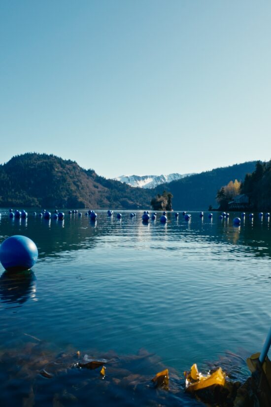
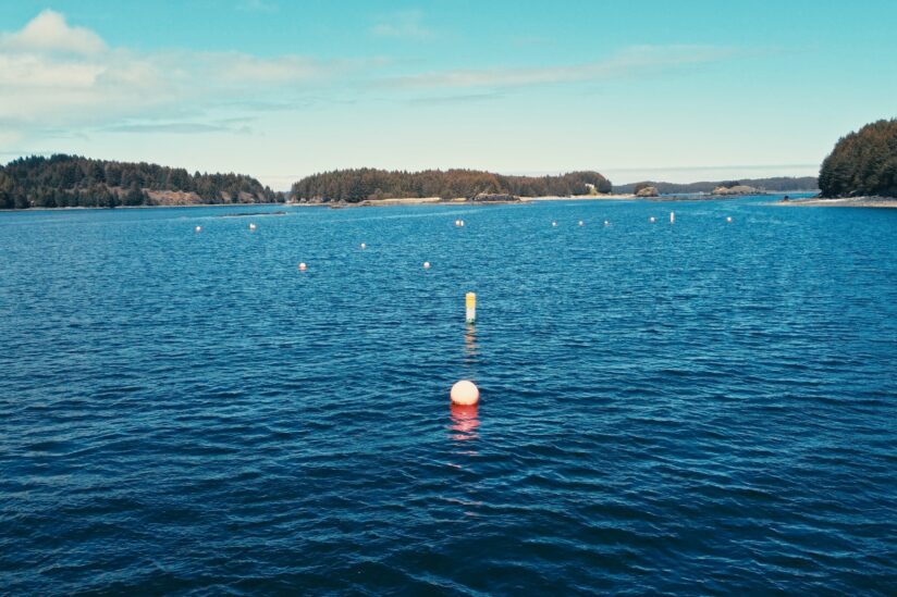
measured in length of growlines
- Distance from shore
- 0.05 - 0.2 miles
- Water depth
- 38 - 70 ft.
- Farm substrate
- Mostly sandy, muddy environments
- Farm site exposure
- Highly location-dependent, bays and islands allow for wind and waves protection
Four primary considerations for proper site selection:
Regulations and Permitting
Logistics
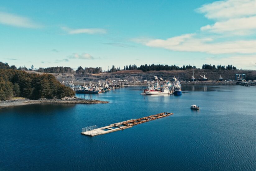
Farmers must consider the proximity of their site to the nearest harbor or port to reduce fuel costs and travel time. These are critical for managing expenses and maintaining the quality of their harvest. To preserve quality, it is essential to stabilize the kelp within 24 hours post-harvest.
Biology
Understanding the potential site's biophysical characteristics is vital to ensure your kelp thrives. Factors such as depth, current, salinity, and nutrient levels play a crucial role. An ideal location offers protection from harsh elements while maintaining adequate nutrient flow. Identifying wild beds of the species nearby can be a good indicator of suitability.
Cultural & social licensing
Considering the site's social and cultural context is necessary to assess the impacts of a potential farm on nearby residents and water users. To gain public support and a "social license to operate," farmers must demonstrate minimal adverse effects on shared resources. Reducing nuisances, clearly marking boundaries, and building good neighbor relationships are essential. Engaging with the community and addressing concerns early can ease the permitting and farming process.
Key Factors
- Water temperature
- 50–71 °F
- Current speed
- 1.6-3.3 ft/s
- Water depth
- 40-60 ft. at Mean Low Tide
-
For suspended stacks lines or rafts. Enough space from the bottom, anchoring lines technical limitations.
- Salinity
- 20-35 ppt
Geography, Environment & Logistics
The site area geomorphology affects the physical and biological parameters such as water movement, turbidity, nutrient and light availability for phytoplankton, wind direction, exposure to extreme weather, winter icing, and more. There is a tradeoff between the amount of protection and current at a site. It is also important to consider sensitive habitat areas and the needs of existing users.
Supporting infrastructures include access to road systems, dock space, land-based processing facilities, waterfront property, and equipment for loading and unloading.
Our location near Woody Island Channel is unique, offering strong tides, significant weather, and excellent storm surge conditions. The high nutrient levels in Chiniak Bay, fueled by upwelling from the deep waters off Kodiak Island, create robust kelp growing conditions throughout the year.
Alaskan seaweed farmers operate under extreme conditions, including heavy winds, currents, storms, and temperatures. Being mindful of where the winds/storms are coming from during the growing season is crucial to accessing the farm and minimizing the suffering from any damage to the crop or the equipment. An essential aspect of site selection is being mindful of the 50-50 rule. The right site will allow the farmer various genetic materials and species to support a farm's long-term success.
The 50-50 rule
The 50-50 Rule, developed in 2016 in the absence of genetic data for Alaska seaweeds and aquatic plants, is a set of guidelines for cultivating seaweeds and aquatic plants in Alaskan waters. It aims to minimize disease transmission, protect genetic fitness in the wild, and maintain genetic diversity within cultured broodstocks. This rule requires that reproductive tissue from at least 50 unrelated individuals per species must be collected annually to produce seed. Seed may then only be out-planted within 50 km of where that source tissue was collected.
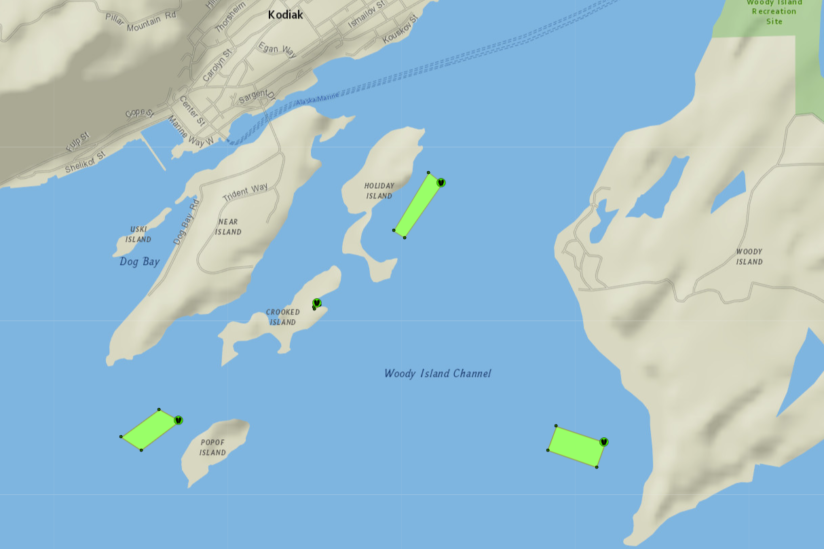
Alaska Ocean Farms chose locations that are protected from north winds, but also allow for nutrient flows and are close to a port with fisheries infrastructure.
Unique opportunities in Alaska to support site selection
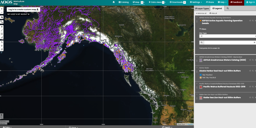
- Alaska Ocean Observing System (AOOS) Mariculture Map: This BETA decision support tool consolidates various datasets, allowing you to explore over 6,600 miles of coastline. Assess seabird colonies, salinity levels, and more. Create General Location Maps, Detailed Location Maps, and Site Plan Maps for your lease and permit applications. Explore the AOOS Mariculture Map
- ADF&G Permitted Operations Map: Discover existing aquatic farms and their permitted activities with this online tool. It displays the locations of current farms and state authorizations, helping you identify potential conflicts with other users. View the ADF&G Map
- Site assessment toolkit: Dr. Schery Umanzor from the University of Alaska Fairbanks and Melissa Good from Alaska Sea Grant, in collaboration with the Native Conservancy, are creating a Site Assessment Toolkit (SAT) to enhance site selection and monitoring practices for mariculture farmers and entrepreneurs. The SAT allows year-round environmental monitoring with supplies for measuring parameters in a durable case.
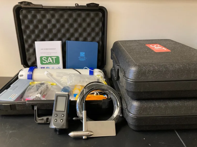
Image credit: Melissa Good